 Historic Marker
Marker · Memory
What Caused the Slide?
Inscription
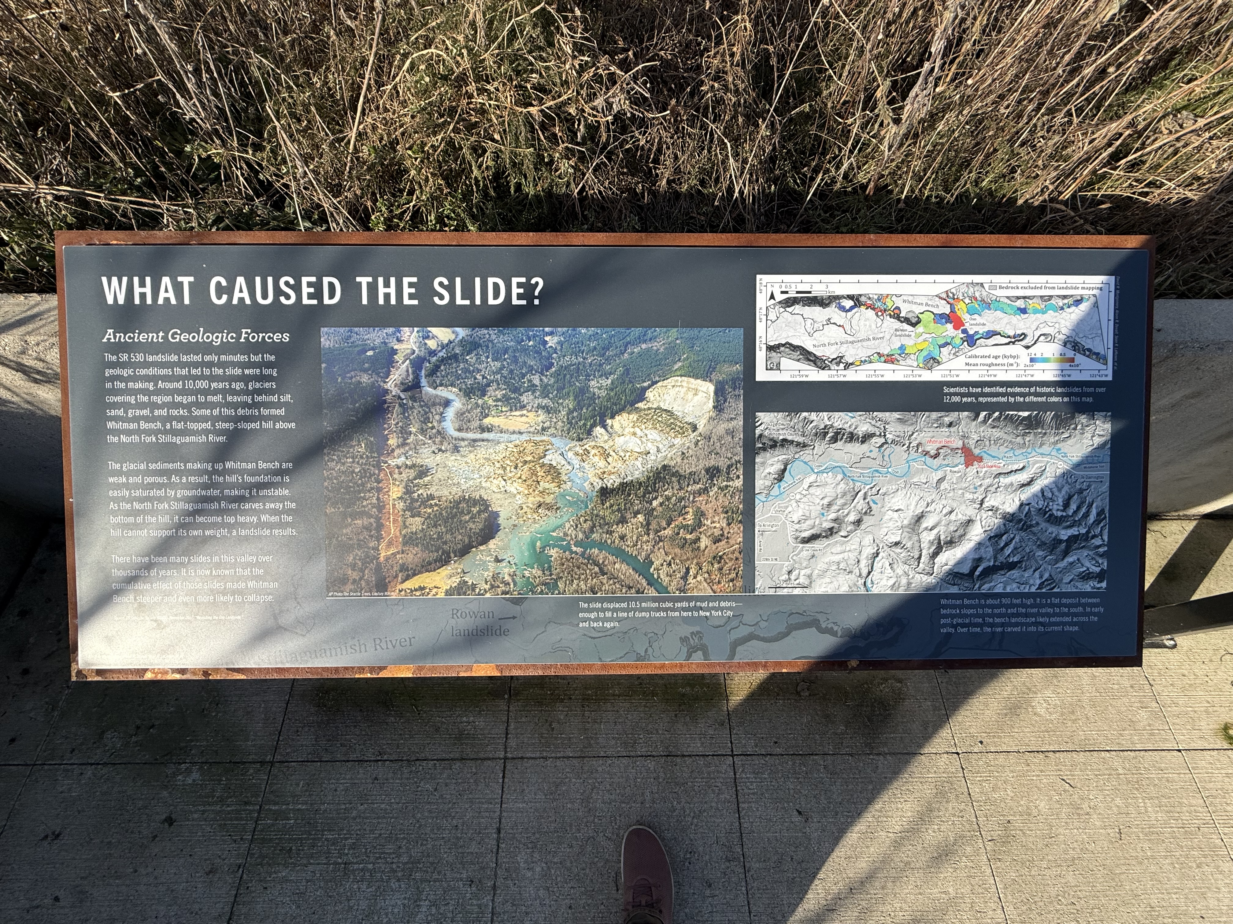
WHAT CAUSED THE SLIDE? Ancient Geologic Forces The SR 530 landslide lasted only minutes but the geologic conditions that led to the slide were long in the making. Around 10,000 years ago, glaciers covering the region began to melt, leaving behind silt, sand, gravel, and rocks. Some of this debris formed Whitman Bench, a flat-topped, steep-sloped hill above the North Fork Stillaguamish River. The glacial sediments making up Whitman Bench are weak and porous. As a result, the hill's foundation is easily saturated by groundwater, making it unstable. As the North Fork Stillaguamish River carves away the bottom of the hill, it can become top heavy. When the hill cannot support its own weight, a landslide results. There have been many slides in this valley over thousands of years. It is now known that the cumulative effect of those slides made Whitman Bench steeper and even more likely to collapse. [UNVERIFIABLE: one-line source credit under the left column, washed out by glare and below the resolution of this photo] [Photo: oblique aerial view of the slide - bare scarp at upper right, tan debris field across the valley floor, the river pooled turquoise below] AP Photo/The Seattle Times, Lindsey [UNVERIFIABLE: surname begins "Wasso", remaining letters lost against bright rock] The slide displaced 10.5 million cubic yards of mud and debris— enough to fill a line of dump trucks from here to New York City and back again. [Map: landslide-inventory map of the valley, mapped deposits shaded in colors keyed to a "Calibrated age (kybp)" and "Mean roughness" scale] David R. Montgomery, Alison R. Duvall, Sean R. LaHusen, et al. Scientists have identified evidence of historic landslides from over 12,000 years, represented by the different colors on this map. [Map: shaded-relief map of the North Fork Stillaguamish valley, labelled Whitman Bench, Oso, Cicero, Trafton and the county line] Whitman Bench is about 900 feet high. It is a flat deposit between bedrock slopes to the north and the river valley to the south. In early post-glacial time, the bench landscape likely extended across the valley. Over time, the river carved it into its current shape. [Map: the panel's lower background is an enlarged section of the landslide map, labelled "...aguamish River" and "Rowan landslide"]
Awaiting verification
Record
- Marker type
- Sign
- Location
- SR 530 Slide Memorial — Snohomish County, Washington
- Added to the archive
- January 25, 2026
Interpretive panel explaining the ancient geologic forces that led to the SR 530 landslide, including glacial deposits, groundwater saturation, and the unstable hillside conditions.
Condition over time